Marine robots let research teams collect images, samples, and measurements where divers cannot work safely or stay long. They also give scientists a way to repeat the same survey across deep water, rough seas, and wide areas.
- ROVs stay connected: A tether sends power, control commands, and live video from the ship.
- AUVs work on their own: An autonomous underwater vehicle follows a planned route without a cable to the surface.
- Sensors add context: Sonar, cameras, water probes, and sample tools show what is below the surface.
Three ways robots work underwater
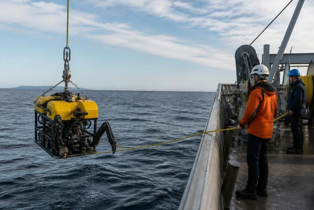
The main split is between remotely operated vehicles and autonomous underwater vehicles. An ROV receives commands from a ship through a tether, so the crew can watch live video and change the plan when they find something unexpected.
An AUV carries its battery, computer, navigation system, and sensors inside the vehicle. It can run a planned survey away from the ship, then return with stored data. That makes it useful for mapping the seafloor or measuring water along a set route.
A third type, the glider, moves by changing its buoyancy. It rises and sinks through the water while its wings turn that motion into forward travel. Gliders can collect repeated water measurements without using a motor for the whole trip.
The machine choice follows the task. A team inspecting a deep wreck needs live control and a camera view. A team measuring temperature across a large area needs long travel and stored measurements.
More data from difficult places
Depth creates pressure, darkness, cold, and poor radio links. Underwater robots handle those conditions with pressure-rated housings, lights, cameras, sonar, and acoustic signals.
Radio waves do not travel far through seawater, so many systems use sound to send small amounts of information. That limit changes how crews work.
An ROV can send video through its tether, while an AUV may store high-resolution images until it reaches the surface. The research team then checks the full record after recovery instead of watching every moment from the ship.
Robots also repeat a path more closely than a diver can. A survey vehicle can follow the same line over a reef, sediment field, or pipeline, which gives scientists comparable measurements over time. The value comes from repeatable work, not from a single dramatic image.
Marine surveys depend on more than a robot reaching the seafloor. Scientists need records that tie each route, sensor, depth, and date to the result, so they can compare changes across repeated trips. Marine robotics reporting from Robot24.com can help you follow those details while the limits researchers still face come into view.
What researchers still have to handle
A robot does not remove the hard parts of ocean research. The team still needs a ship, trained operators, launch equipment, recovery plans, and a method for checking whether the sensors produced usable data.
Navigation can also drift underwater. GPS signals work at the surface, but they do not reach a vehicle operating at depth. AUVs may combine inertial sensors, depth readings, acoustic transmitters, and seafloor maps to estimate their position.
Communication adds another limit. Acoustic links can work across water, but they carry less data and may have delays. A vehicle that loses contact may need to pause, return to a set point, or finish its route without new commands.
Power sets another boundary. Cameras, lights, sonar, thrusters, computers, and sample tools all draw from the same battery on an untethered vehicle. A longer survey can require lower speed, fewer lights, less sonar time, or a return to the ship before the work is finished.
The evidence also needs care. A camera image can show an animal or a damaged structure, but it may not explain why it is there or how long the condition has lasted. Scientists still compare robot data with water samples, older surveys, and other field records.
A practical choice for a research team
Before selecting a marine robot, the team should match the vehicle to the work:
- Set the depth first. Check the vehicle’s rated operating depth against the planned site, including a margin for weather and recovery.
- Choose live control or stored data. Use an ROV when the crew must react during the survey; use an AUV when a planned route covers more water.
- List every sensor. A camera cannot replace sonar, and a water probe cannot replace a physical sample.
- Plan the battery budget. Count travel, survey speed, lights, sensors, and the return trip before setting the route.
- Check recovery. Define what happens after lost contact, low battery, bad weather, or a failed launch.
- Set a data check. Decide how the team will confirm sensor readings and compare them with older records.
I'd choose the simplest vehicle that can collect the needed evidence, because extra hardware adds weight, power use, and more ways for a field mission to fail.
Marine robots will keep taking on work that is deep, dark, cold, or too broad for divers. The next useful step is not a bigger claim about autonomy; it is a repeatable survey that produces data scientists can check and use.